Geolocate

Cala d'Or topographic map

Click on the map to display elevation.

About this map

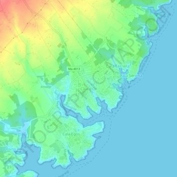
Name: Cala d'Or topographic map, elevation, terrain.

Location: Cala d'Or, Santanyí, Migjorn, Balearic Islands, 07660, Spain (39.35490 3.21029 39.39490 3.25029)

Average elevation: 56 ft

Minimum elevation: -3 ft

Maximum elevation: 217 ft

Gear up for your next adventure:

🗺️NatGeo Topo Maps - High-quality waterproof printed topographic maps of US Parks
🧭Hiking Compass - Precision compass for reliable navigation in the wilderness
🧯Emergency Survival Kit - All‑in‑one survival essentials for the backcountry
🧭Orienteering Set - Complete compass and map reading kit
🧦Hiking Socks - Comfortable socks to prevent blisters on long hikes

As an Amazon Associate, this site earns from qualifying purchases at no extra cost to you.