
Clio topographic map
Click on the map to display elevation.
About this map
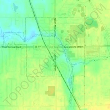
Name: Clio topographic map, elevation, terrain.
Location: Clio, Genesee County, Michigan, 48420, United States (43.16602 -83.75213 43.18482 -83.72468)
Average elevation: 728 ft
Minimum elevation: 686 ft
Maximum elevation: 761 ft
Genesee County trails, hiking, mountain biking, running and outdoor activities
Other topographic maps
Click on a map to view its topography, its elevation and its terrain.
Genessee County Recreational Area
United States > Michigan > Genesee County > Genesee Charter Township
Average elevation: 758 ft