
Ocotepec de Morelos topographic map
Interactive map
Click on the map to display elevation.
About this map
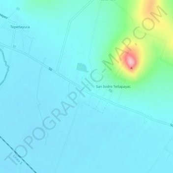
Name: Ocotepec de Morelos topographic map, elevation, terrain.
Location: Ocotepec de Morelos, Almoloya, Hidalgo, México (19.65222 -98.39972 19.69222 -98.35972)
Average elevation: 8,291 ft
Minimum elevation: 8,209 ft
Maximum elevation: 8,832 ft
Other topographic maps
Click on a map to view its topography, its elevation and its terrain.