
Thank you for supporting this site ❤️
Make a donation
Make a donation
Gear up for your next adventure:
As an Amazon Associate, this site earns from qualifying purchases at no extra cost to you.
Gachoka topographic map
Click on the map to display elevation.
Thank you for supporting this site ❤️
Make a donation
Make a donation
Gear up for your next adventure:
As an Amazon Associate, this site earns from qualifying purchases at no extra cost to you.
About this map
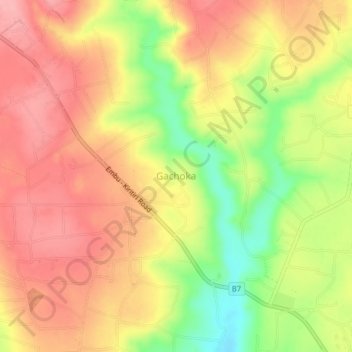
Name: Gachoka topographic map, elevation, terrain.
Location: Gachoka, Mbeere South, Embu, Eastern, Kenya (-0.63660 37.51330 -0.59660 37.55330)
Average elevation: 3,852 ft
Minimum elevation: 3,622 ft
Maximum elevation: 4,003 ft
Thank you for supporting this site ❤️
Make a donation
Make a donation
Gear up for your next adventure:
As an Amazon Associate, this site earns from qualifying purchases at no extra cost to you.