
Thank you for supporting this site ❤️
Make a donation
Make a donation
Gear up for your next adventure:
As an Amazon Associate, this site earns from qualifying purchases at no extra cost to you.
Hutchinson topographic map
Click on the map to display elevation.
Thank you for supporting this site ❤️
Make a donation
Make a donation
Gear up for your next adventure:
As an Amazon Associate, this site earns from qualifying purchases at no extra cost to you.
About this map
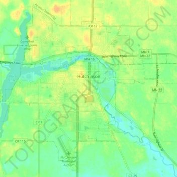
Name: Hutchinson topographic map, elevation, terrain.
Location: Hutchinson, McLeod County, Minnesota, 55350, United States (44.85246 -94.42203 44.91404 -94.32808)
Average elevation: 1,063 ft
Minimum elevation: 1,020 ft
Maximum elevation: 1,115 ft
McLeod County trails, hiking, mountain biking, running and outdoor activities
Thank you for supporting this site ❤️
Make a donation
Make a donation
Gear up for your next adventure:
As an Amazon Associate, this site earns from qualifying purchases at no extra cost to you.