Geolocate

Duffield topographic map

Click on the map to display elevation.

About this map

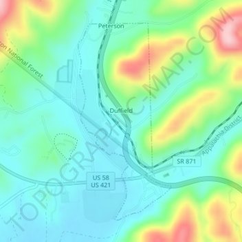
Name: Duffield topographic map, elevation, terrain.

Location: Duffield, Scott County, Virginia, United States (36.70672 -82.80201 36.72872 -82.78905)

Average elevation: 1,486 ft

Minimum elevation: 1,299 ft

Maximum elevation: 1,969 ft

Scott County trails, hiking, mountain biking, running and outdoor activities

Other topographic maps

Click on a map to view its topography, its elevation and its terrain.

Craft Mill

United States > Virginia > Scott County

Average elevation: 1,608 ft

McCorkle

United States > Virginia > Scott County

Average elevation: 1,699 ft

Purchase Knob

United States > Virginia > Scott County

Average elevation: 1,663 ft

Hiltons

United States > Virginia > Scott County

Average elevation: 1,683 ft

Gear up for your next adventure:

🪶Thermal Camp Blanket - Extra warmth for cold nights
🪶Camp Gear Gift Set - Perfect gift bundle for outdoor fans
🦺Reflective Outdoor Gear - Safety gear for low‑light conditions
Camping Coffee Makers - Enjoy premium coffee at the summit or campsite
🏔️Mountain Trail Maps - High‑detail maps for popular peaks

As an Amazon Associate, this site earns from qualifying purchases at no extra cost to you.