
Thank you for supporting this site ❤️
Make a donation
Make a donation
Gear up for your next adventure:
As an Amazon Associate, this site earns from qualifying purchases at no extra cost to you.
Pratteln topographic map
Click on the map to display elevation.
Thank you for supporting this site ❤️
Make a donation
Make a donation
Gear up for your next adventure:
As an Amazon Associate, this site earns from qualifying purchases at no extra cost to you.
About this map
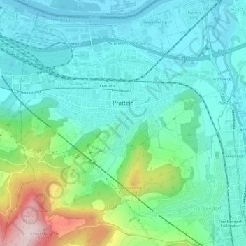
Name: Pratteln topographic map, elevation, terrain.
Location: Pratteln, Bezirk Liestal, Basel-Landschaft, 4133, Switzerland (47.49687 7.66612 47.53518 7.72063)
Average elevation: 1,152 ft
Minimum elevation: 840 ft
Maximum elevation: 2,185 ft
Thank you for supporting this site ❤️
Make a donation
Make a donation
Gear up for your next adventure:
As an Amazon Associate, this site earns from qualifying purchases at no extra cost to you.