
Thank you for supporting this site ❤️
Make a donation
Make a donation
Gear up for your next adventure:
As an Amazon Associate, this site earns from qualifying purchases at no extra cost to you.
Melezzole topographic map
Click on the map to display elevation.
Thank you for supporting this site ❤️
Make a donation
Make a donation
Gear up for your next adventure:
As an Amazon Associate, this site earns from qualifying purchases at no extra cost to you.
About this map
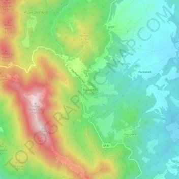
Name: Melezzole topographic map, elevation, terrain.
Location: Melezzole, Montecchio, Terni, Umbria, 05020, Italia (42.64802 12.31796 42.68802 12.35796)
Average elevation: 1,969 ft
Minimum elevation: 1,230 ft
Maximum elevation: 3,245 ft
Thank you for supporting this site ❤️
Make a donation
Make a donation
Gear up for your next adventure:
As an Amazon Associate, this site earns from qualifying purchases at no extra cost to you.