
Thank you for supporting this site ❤️
Make a donation
Make a donation
Gear up for your next adventure:
As an Amazon Associate, this site earns from qualifying purchases at no extra cost to you.
Pocoata topographic map
Click on the map to display elevation.
Thank you for supporting this site ❤️
Make a donation
Make a donation
Gear up for your next adventure:
As an Amazon Associate, this site earns from qualifying purchases at no extra cost to you.
About this map
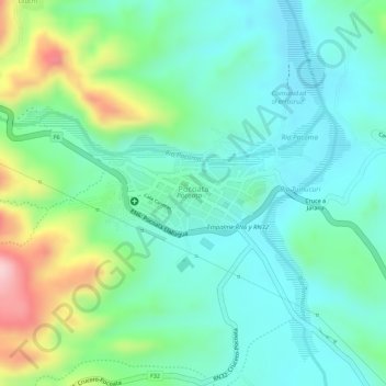
Name: Pocoata topographic map, elevation, terrain.
Location: Pocoata, Provincia Chayanta, Potosí, Bolivia (-18.70181 -66.16887 -18.69659 -66.15735)
Average elevation: 11,119 ft
Minimum elevation: 10,906 ft
Maximum elevation: 11,624 ft
Thank you for supporting this site ❤️
Make a donation
Make a donation
Gear up for your next adventure:
As an Amazon Associate, this site earns from qualifying purchases at no extra cost to you.