
Make a donation
Gear up for your next adventure:
As an Amazon Associate, this site earns from qualifying purchases at no extra cost to you.
Betma topographic map
Click on the map to display elevation.
Make a donation
Gear up for your next adventure:
As an Amazon Associate, this site earns from qualifying purchases at no extra cost to you.
Betma
Betma is located at 22°41′N 75°37′E / 22.68°N 75.62°E / 22.68; 75.62. It has an average elevation of 541 metres (1774 feet).
Make a donation
Gear up for your next adventure:
As an Amazon Associate, this site earns from qualifying purchases at no extra cost to you.
About this map
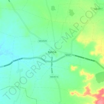
Name: Betma topographic map, elevation, terrain.
Location: Betma, Depalpur Tahsil, Indore, Madhya Pradesh, 453001, India (22.64751 75.57167 22.72751 75.65167)
Average elevation: 1,808 ft
Minimum elevation: 1,736 ft
Maximum elevation: 2,008 ft
Make a donation
Gear up for your next adventure:
As an Amazon Associate, this site earns from qualifying purchases at no extra cost to you.
Other topographic maps
Click on a map to view its topography, its elevation and its terrain.