Geolocate

Waksai topographic map

Click on the map to display elevation.

About this map

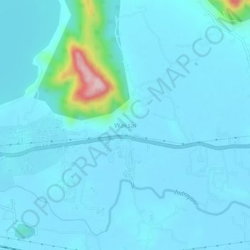
Name: Waksai topographic map, elevation, terrain.

Location: Waksai, Mawal, Pune District, Maharashtra, 410405, India (18.74363 73.43275 18.78363 73.47275)

Average elevation: 2,083 ft

Minimum elevation: 2,011 ft

Maximum elevation: 2,841 ft

Other topographic maps

Click on a map to view its topography, its elevation and its terrain.

Tung Fort

India > Maharashtra > Mawal

Average elevation: 2,405 ft

Tikona Fort

India > Maharashtra > Mawal > Tikona Peth

Average elevation: 2,434 ft

Pavana Dam

India > Maharashtra > Mawal > Kale Colony

Average elevation: 2,001 ft

Kasarsai

India > Maharashtra > Mawal > Pachane

Average elevation: 2,146 ft

Patan

India > Maharashtra > Mawal

Average elevation: 2,260 ft

Gear up for your next adventure:

💧Water Filtration Bottles - Safely drink from streams and lakes while exploring
🧥Men's Rain Shells - Premium waterproof and breathable jackets for mountain weather
🔋Rechargeable Batteries - Power up your outdoor devices
🧺Microfiber Travel Towels - Compact and fast-drying towels for trail use
🗃️Trail First Aid Kit - Essential kit for outdoor injuries and emergencies

As an Amazon Associate, this site earns from qualifying purchases at no extra cost to you.