
Thank you for supporting this site ❤️
Make a donation
Make a donation
Gear up for your next adventure:
As an Amazon Associate, this site earns from qualifying purchases at no extra cost to you.
Mzuzu topographic map
Click on the map to display elevation.
Thank you for supporting this site ❤️
Make a donation
Make a donation
Gear up for your next adventure:
As an Amazon Associate, this site earns from qualifying purchases at no extra cost to you.
About this map
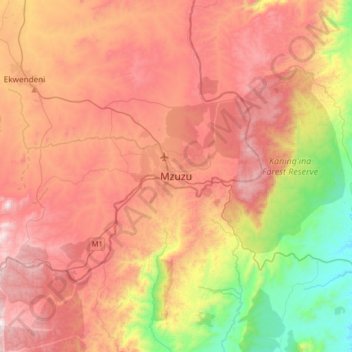
Name: Mzuzu topographic map, elevation, terrain.
Location: Mzuzu, Mzimba, Northern Region, Malawi, Malawi (-11.62075 33.86264 -11.30075 34.18264)
Average elevation: 3,789 ft
Minimum elevation: 1,808 ft
Maximum elevation: 5,531 ft
Thank you for supporting this site ❤️
Make a donation
Make a donation
Gear up for your next adventure:
As an Amazon Associate, this site earns from qualifying purchases at no extra cost to you.