
Thank you for supporting this site ❤️
Make a donation
Make a donation
Gear up for your next adventure:
As an Amazon Associate, this site earns from qualifying purchases at no extra cost to you.
Deokjin-gu topographic map
Click on the map to display elevation.
Thank you for supporting this site ❤️
Make a donation
Make a donation
Gear up for your next adventure:
As an Amazon Associate, this site earns from qualifying purchases at no extra cost to you.
About this map
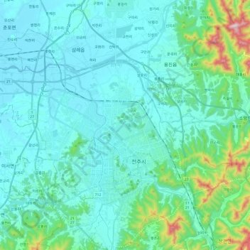
Name: Deokjin-gu topographic map, elevation, terrain.
Location: Deokjin-gu, Jeonju-si, Jeonbuk State, South Korea (35.80173 126.99784 35.90132 127.23437)
Average elevation: 315 ft
Minimum elevation: 7 ft
Maximum elevation: 2,178 ft
Thank you for supporting this site ❤️
Make a donation
Make a donation
Gear up for your next adventure:
As an Amazon Associate, this site earns from qualifying purchases at no extra cost to you.