
Thank you for supporting this site ❤️
Make a donation
Make a donation
Gear up for your next adventure:
As an Amazon Associate, this site earns from qualifying purchases at no extra cost to you.
Azambuja topographic map
Click on the map to display elevation.
Thank you for supporting this site ❤️
Make a donation
Make a donation
Gear up for your next adventure:
As an Amazon Associate, this site earns from qualifying purchases at no extra cost to you.
About this map
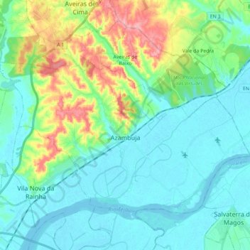
Name: Azambuja topographic map, elevation, terrain.
Location: Azambuja, Lisboa, Lezíria do Tejo, Alentejo, Portugal (39.02780 -8.95608 39.12268 -8.78186)
Average elevation: 95 ft
Minimum elevation: -7 ft
Maximum elevation: 400 ft
Thank you for supporting this site ❤️
Make a donation
Make a donation
Gear up for your next adventure:
As an Amazon Associate, this site earns from qualifying purchases at no extra cost to you.