
Cabudare topographic map
Click on the map to display elevation.
Cabudare
Cabudare (Spanish pronunciation: [kaβuˈðaɾe], original indigenous name Kabudari), is a city in Lara State, in Venezuela, and capital of the Palavecino Municipality. Located at an elevation of 400 m on the Turbio River, it is on the major west-central freeway, the Autopista Centro Occidental. Due to the growth of the economy in Barquisimeto, Cabudare has become a bedroom community, with new housing construction replacing the sugar cane fields. A minority of the population are still engaged in agriculture within the municipality.
About this map
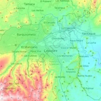
Name: Cabudare topographic map, elevation, terrain.
Average elevation: 2,090 ft
Minimum elevation: 925 ft
Maximum elevation: 5,676 ft