
Thank you for supporting this site ❤️
Make a donation
Make a donation
Gear up for your next adventure:
As an Amazon Associate, this site earns from qualifying purchases at no extra cost to you.
Vellerat topographic map
Click on the map to display elevation.
Thank you for supporting this site ❤️
Make a donation
Make a donation
Gear up for your next adventure:
As an Amazon Associate, this site earns from qualifying purchases at no extra cost to you.
About this map
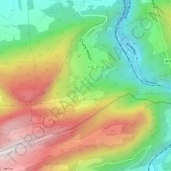
Name: Vellerat topographic map, elevation, terrain.
Location: Vellerat, Courrendlin, District de Delémont, Jura, 2830, Suisse (47.30587 7.34836 47.32650 7.37863)
Average elevation: 2,425 ft
Minimum elevation: 1,476 ft
Maximum elevation: 3,625 ft
Thank you for supporting this site ❤️
Make a donation
Make a donation
Gear up for your next adventure:
As an Amazon Associate, this site earns from qualifying purchases at no extra cost to you.