Geolocate

Kuthar topographic map

Click on the map to display elevation.

About this map

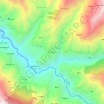
Name: Kuthar topographic map, elevation, terrain.

Location: Kuthar, Theog, Shimla, Himachal Pradesh, 171226, India (30.98493 77.39746 31.02493 77.43746)

Average elevation: 5,151 ft

Minimum elevation: 3,825 ft

Maximum elevation: 7,185 ft

Gear up for your next adventure:

🛌Ultralight Sleeping Bags - Compact down bags for cold nights in the wilderness
🛏️Cold Weather Sleeping Bag - Warm sleeping bag for cold conditions
🦶Carbon Trekking Poles - Reduce knee impact on steep descents with ultra-light poles
🪶LED Camping Lantern - Bright lantern for camp lighting
🧯Portable Fire Pit - Compact fire pit for camping spots

As an Amazon Associate, this site earns from qualifying purchases at no extra cost to you.