
Thank you for supporting this site ❤️
Make a donation
Make a donation
Gear up for your next adventure:
As an Amazon Associate, this site earns from qualifying purchases at no extra cost to you.
Amaloy topographic map
Click on the map to display elevation.
Thank you for supporting this site ❤️
Make a donation
Make a donation
Gear up for your next adventure:
As an Amazon Associate, this site earns from qualifying purchases at no extra cost to you.
About this map
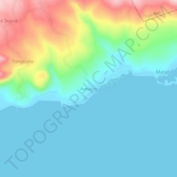
Name: Amaloy topographic map, elevation, terrain.
Location: Amaloy, Ungkaya Pukan, Basilan, Bangsamoro, Philippines (6.42342 122.10516 6.46342 122.14516)
Average elevation: 203 ft
Minimum elevation: -3 ft
Maximum elevation: 814 ft
Thank you for supporting this site ❤️
Make a donation
Make a donation
Gear up for your next adventure:
As an Amazon Associate, this site earns from qualifying purchases at no extra cost to you.