
Thank you for supporting this site ❤️
Make a donation
Make a donation
Gear up for your next adventure:
As an Amazon Associate, this site earns from qualifying purchases at no extra cost to you.
Rofes topographic map
Click on the map to display elevation.
Thank you for supporting this site ❤️
Make a donation
Make a donation
Gear up for your next adventure:
As an Amazon Associate, this site earns from qualifying purchases at no extra cost to you.
About this map
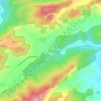
Name: Rofes topographic map, elevation, terrain.
Location: Rofes, la Llacuna, Anoia, Barcelona, Catalonia, 08779, Spain (41.47320 1.54897 41.51320 1.58897)
Average elevation: 1,952 ft
Minimum elevation: 1,506 ft
Maximum elevation: 2,612 ft
Thank you for supporting this site ❤️
Make a donation
Make a donation
Gear up for your next adventure:
As an Amazon Associate, this site earns from qualifying purchases at no extra cost to you.