
Isle of Sheppey topographic map
Interactive map
Click on the map to display elevation.
About this map
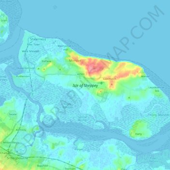
Name: Isle of Sheppey topographic map, elevation, terrain.
Location: Isle of Sheppey, Borough of Swale, Kent, England, United Kingdom (51.35449 0.72172 51.44779 0.95090)
Average elevation: 20 ft
Minimum elevation: -13 ft
Maximum elevation: 243 ft
Other topographic maps
Click on a map to view its topography, its elevation and its terrain.
Sheerness
United Kingdom > England > Kent > Borough of Swale
Sheerness, Borough of Swale, Kent, England, United Kingdom
Average elevation: 10 ft
Teynham
United Kingdom > England > Kent > Borough of Swale > Conyer
Teynham, Conyer, Borough of Swale, Kent, England, United Kingdom
Average elevation: 20 ft