
Richborough topographic map
Click on the map to display elevation.
About this map
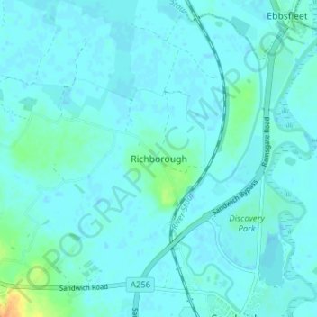
Name: Richborough topographic map, elevation, terrain.
Location: Richborough, Dover, Kent, England, CT13 9JH, United Kingdom (51.27547 1.30524 51.31547 1.34524)
Average elevation: 13 ft
Minimum elevation: -3 ft
Maximum elevation: 102 ft
Other topographic maps
Click on a map to view its topography, its elevation and its terrain.
White Cliffs of Dover
United Kingdom > England > Kent > Dover > St. Margaret's at Cliffe
Average elevation: 161 ft