Geolocate

Kouffo Department topographic map

Click on the map to display elevation.

About this map
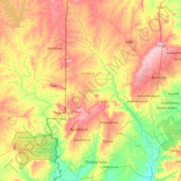
Name: Kouffo Department topographic map, elevation, terrain.

Location: Kouffo Department, Benin (6.71485 1.55903 7.53006 2.09639)

Average elevation: 397 ft

Minimum elevation: 16 ft

Maximum elevation: 902 ft

Other topographic maps

Click on a map to view its topography, its elevation and its terrain.

Serou

Benin > Borgou Department > Sinendé

Average elevation: 1,181 ft

COBI

Benin > Borgou Department > Nikki

Average elevation: 1,493 ft

Adourekoman

Benin > Collines Department > Glazoué

Average elevation: 509 ft

Tanguieta

Benin > Atakora Department > Tanguièta

Average elevation: 961 ft

Gear up for your next adventure:

⛺Backpacking Tents - Weight-optimized shelters for multi-day topographic surveys
📻Weather Alert Radios - Stay informed of storm risks while off-the-grid
🪶LED Camping Lantern - Bright lantern for camp lighting
🏕️Tent Footprint - Protect your tent base from wear
🧤Tactile Hiking Gloves - Keep hands warm while operating GPS and smartphone screens

As an Amazon Associate, this site earns from qualifying purchases at no extra cost to you.