
Make a donation
Gear up for your next adventure:
As an Amazon Associate, this site earns from qualifying purchases at no extra cost to you.
Schreckhorn topographic map
Click on the map to display elevation.
Make a donation
Gear up for your next adventure:
As an Amazon Associate, this site earns from qualifying purchases at no extra cost to you.
Schreckhorn
Le Schreckhorn, culminant à 4 078 m d'altitude, est le sommet de plus de 4 000 mètres d'altitude le plus septentrional des Alpes bernoises. Il est considéré par les alpinistes comme l'un des plus difficiles à gravir des Alpes bernoises, voire des Alpes suisses.
Make a donation
Gear up for your next adventure:
As an Amazon Associate, this site earns from qualifying purchases at no extra cost to you.
About this map
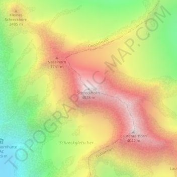
Name: Schreckhorn topographic map, elevation, terrain.
Average elevation: 10,732 ft
Minimum elevation: 8,028 ft
Maximum elevation: 13,350 ft
Make a donation
Gear up for your next adventure:
As an Amazon Associate, this site earns from qualifying purchases at no extra cost to you.