
Make a donation
Gear up for your next adventure:
As an Amazon Associate, this site earns from qualifying purchases at no extra cost to you.
Évora topographic map
Click on the map to display elevation.
Make a donation
Gear up for your next adventure:
As an Amazon Associate, this site earns from qualifying purchases at no extra cost to you.
Évora
O Concelho de Évora localiza-se em meio à grande planície alentejana, caracterizada por uma ondulação muito suave e altitude média de 240 metros. Com uma área de 1309 km², o concelho ocupa 5% da superfície da região do Alentejo. A área urbana de Évora abrange 1643 ha.
Make a donation
Gear up for your next adventure:
As an Amazon Associate, this site earns from qualifying purchases at no extra cost to you.
About this map
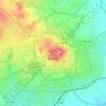
Name: Évora topographic map, elevation, terrain.
Location: Évora, Alentejo Central, Alentejo, Portugal (38.56623 -7.91548 38.57798 -7.90085)
Average elevation: 889 ft
Minimum elevation: 794 ft
Maximum elevation: 1,020 ft
Make a donation
Gear up for your next adventure:
As an Amazon Associate, this site earns from qualifying purchases at no extra cost to you.