
Iron Horse topographic map
Interactive map
Click on the map to display elevation.
About this map
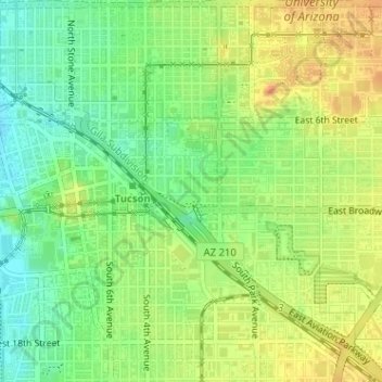
Name: Iron Horse topographic map, elevation, terrain.
Location: Iron Horse, Tucson, Pima County, Arizona, United States (32.22037 -110.96606 32.22516 -110.95945)
Average elevation: 2,415 ft
Minimum elevation: 2,349 ft
Maximum elevation: 2,474 ft
Pima County trails, hiking, mountain biking, running and outdoor activities
Other topographic maps
Click on a map to view its topography, its elevation and its terrain.
Tucson
United States > Arizona > Pima County > Tucson
The city's elevation is 2,643 ft (806 m) above sea level (as measured at the Tucson International Airport). Tucson is on an alluvial plain in the Sonoran Desert, surrounded by five minor ranges of mountains: the Santa Catalina Mountains and the Tortolita Mountains to the north, the Santa Rita Mountains to the…
Average elevation: 2,743 ft