
Thank you for supporting this site ❤️
Make a donation
Make a donation
Gear up for your next adventure:
As an Amazon Associate, this site earns from qualifying purchases at no extra cost to you.
Shihezi topographic map
Click on the map to display elevation.
Thank you for supporting this site ❤️
Make a donation
Make a donation
Gear up for your next adventure:
As an Amazon Associate, this site earns from qualifying purchases at no extra cost to you.
About this map
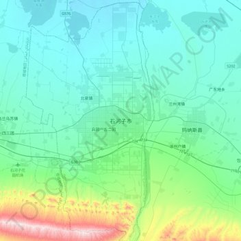
Name: Shihezi topographic map, elevation, terrain.
Location: Shihezi, 第八师, Shihezi City, Xinjiang, 832003, China (44.14170 85.91756 44.46170 86.23756)
Average elevation: 1,732 ft
Minimum elevation: 1,250 ft
Maximum elevation: 4,124 ft
Thank you for supporting this site ❤️
Make a donation
Make a donation
Gear up for your next adventure:
As an Amazon Associate, this site earns from qualifying purchases at no extra cost to you.