Geolocate

Lenox topographic map

Click on the map to display elevation.

About this map

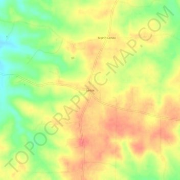
Name: Lenox topographic map, elevation, terrain.

Location: Lenox, Dent County, Missouri, 65541, United States (37.63310 -91.78126 37.67310 -91.74126)

Average elevation: 1,250 ft

Minimum elevation: 1,132 ft

Maximum elevation: 1,335 ft

Dent County trails, hiking, mountain biking, running and outdoor activities

Gear up for your next adventure:

🧢Sun Protection Hats - Wide-brimmed and UPF-rated hats for high-altitude sun safety
🧦Hiking Socks - Comfortable socks to prevent blisters on long hikes
📷Action Camera - Capture your outdoor adventures in HD
🦶Hiking Gaiters - Keep debris and water out of your boots
🪶Compact Camp Shovel - Folding shovel for campsite tasks

As an Amazon Associate, this site earns from qualifying purchases at no extra cost to you.