

Niksar topographic map
Click on the map to display elevation.
Niksar
Niksar is approximately 9,555 km2 (3,689 sq mi). It is located at 40°35' north latitude and 36°58' east longitude. Its average altitude is 350m above sea level. It is surrounded by Erbaa on the northwest, Tokat on the southwest, Almus on the south, Başçiftlik on the southeast and Akkuş on the north. It is one of the five largest counties of Tokat. The Canik Mountains are to the north, Dönek Mountain to the south, and the Niksar Lowland is situated between these mountains. The Niksar Lowland is one of the most important lowlands of the Black Sea Region. The Canik Mountains are covered with plateaus that lie parallel to the Black Sea. Çamiçi High Plateau is one of the most important ones.
About this map
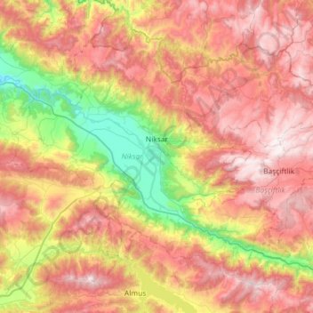
Name: Niksar topographic map, elevation, terrain.
Location: Niksar, Tokat, Black Sea Region, 60600, Turkey (40.38944 36.67206 40.74426 37.24789)
Average elevation: 3,310 ft
Minimum elevation: 699 ft
Maximum elevation: 5,981 ft