
Make a donation
Gear up for your next adventure:
As an Amazon Associate, this site earns from qualifying purchases at no extra cost to you.
Assum topographic map
Click on the map to display elevation.
Make a donation
Gear up for your next adventure:
As an Amazon Associate, this site earns from qualifying purchases at no extra cost to you.
About this map
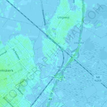
Name: Assum topographic map, elevation, terrain.
Location: Assum, Uitgeest, Noord-Holland, Nederland, 1911 MD, Nederland (52.49678 4.68297 52.53678 4.72297)
Average elevation: 0 ft
Minimum elevation: -20 ft
Maximum elevation: 16 ft
Make a donation
Gear up for your next adventure:
As an Amazon Associate, this site earns from qualifying purchases at no extra cost to you.
Other topographic maps
Click on a map to view its topography, its elevation and its terrain.
Uitgeest
Nederland > Noord-Holland > Uitgeest
Ooit bestond Uitgeest uit waddengebied, vanaf ca. 3000 v.Chr. ontstonden achter een keten van strandwallen, die zich uitstrekten vanaf de keileemhoogten van Wieringen en Texel tot de rotskust van Frankrijk. Deze strandwallen werden doorsneden door zeearmen en rivieren. Toen het waddengebied van de zee…
Average elevation: -3 ft