Geolocate

Fort Thomas topographic map

Click on the map to display elevation.

About this map

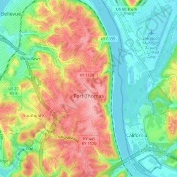
Name: Fort Thomas topographic map, elevation, terrain.

Location: Fort Thomas, Campbell County, Kentucky, 41075, United States (39.05088 -84.47307 39.11133 -84.42890)

Average elevation: 630 ft

Minimum elevation: 459 ft

Maximum elevation: 869 ft

Campbell County trails, hiking, mountain biking, running and outdoor activities

Gear up for your next adventure:

👟Men's Trail Runners - Lightweight footwear for fast-paced exploration and light hiking
🥄Camping Utensil Set - Lightweight utensils for outdoor meals
🛰️Satellite Messengers - Emergency SOS and two-way messaging for off-grid adventures
🦟Ultrasonic Repellers - Create a bug-free zone at your camp or rest stop
🚁Photography Drones - Capture stunning aerial views of landforms and topography

As an Amazon Associate, this site earns from qualifying purchases at no extra cost to you.