
Thank you for supporting this site ❤️
Make a donation
Make a donation
Gear up for your next adventure:
As an Amazon Associate, this site earns from qualifying purchases at no extra cost to you.
Rumisapa topographic map
Click on the map to display elevation.
Thank you for supporting this site ❤️
Make a donation
Make a donation
Gear up for your next adventure:
As an Amazon Associate, this site earns from qualifying purchases at no extra cost to you.
About this map
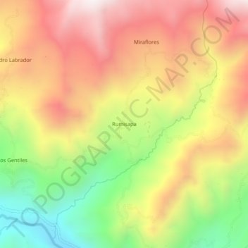
Name: Rumisapa topographic map, elevation, terrain.
Location: Rumisapa, Chontalí, Jaén, Cajamarca, Perú (-5.64216 -79.12389 -5.60216 -79.08389)
Average elevation: 6,283 ft
Minimum elevation: 4,560 ft
Maximum elevation: 7,802 ft
Thank you for supporting this site ❤️
Make a donation
Make a donation
Gear up for your next adventure:
As an Amazon Associate, this site earns from qualifying purchases at no extra cost to you.