Geolocate

Pinquiray topographic map

Click on the map to display elevation.

About this map

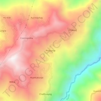
Name: Pinquiray topographic map, elevation, terrain.

Location: Pinquiray, Umari, Provincia de Pachitea, Huánuco, Perú (-9.86685 -75.98382 -9.82685 -75.94382)

Average elevation: 8,871 ft

Minimum elevation: 6,834 ft

Maximum elevation: 10,344 ft

Gear up for your next adventure:

🚑Emergency Bivvies - Heat-reflective sleeping bags for survival situations
🪶Wildlife Field Guides - Learn animal tracking and species ID
Solar GPS Watches - Advanced multisport watches with built-in topographic maps
🏕️Tent Footprint - Protect your tent base from wear
📡Handheld GPS Device - Reliable handheld GPS for outdoor navigation

As an Amazon Associate, this site earns from qualifying purchases at no extra cost to you.