Geolocate

Jonestown topographic map

Click on the map to display elevation.

About this map

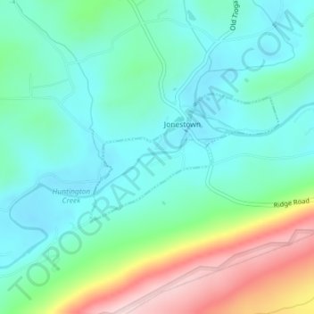
Name: Jonestown topographic map, elevation, terrain.

Location: Jonestown, Columbia County, Pennsylvania, United States (41.12090 -76.31458 41.13180 -76.29307)

Average elevation: 919 ft

Minimum elevation: 666 ft

Maximum elevation: 1,604 ft

Columbia County trails, hiking, mountain biking, running and outdoor activities

Gear up for your next adventure:

🌡️Portable Weather Meter - Track weather conditions on the trail
📷Action Cameras - Rugged cameras to document your journeys across rugged terrain
🚗GPS Dash Cams - Record your scenic drives through mountain passes and canyons
🥩Freeze-Dried Meals - Nutritious and lightweight food for remote expeditions
🏕️Family Camping Gear - Essentials for group camping trips

As an Amazon Associate, this site earns from qualifying purchases at no extra cost to you.