
Thank you for supporting this site ❤️
Make a donation
Make a donation
Gear up for your next adventure:
As an Amazon Associate, this site earns from qualifying purchases at no extra cost to you.
Sondor topographic map
Click on the map to display elevation.
Thank you for supporting this site ❤️
Make a donation
Make a donation
Gear up for your next adventure:
As an Amazon Associate, this site earns from qualifying purchases at no extra cost to you.
About this map
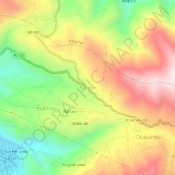
Name: Sondor topographic map, elevation, terrain.
Location: Sondor, San Jerónimo, Andahuaylas, Apurímac, 03730, Perú (-13.66520 -73.35118 -13.62520 -73.31118)
Average elevation: 10,922 ft
Minimum elevation: 9,852 ft
Maximum elevation: 12,021 ft
Thank you for supporting this site ❤️
Make a donation
Make a donation
Gear up for your next adventure:
As an Amazon Associate, this site earns from qualifying purchases at no extra cost to you.