
Make a donation
Gear up for your next adventure:
As an Amazon Associate, this site earns from qualifying purchases at no extra cost to you.
Tayma topographic map
Click on the map to display elevation.
Make a donation
Gear up for your next adventure:
As an Amazon Associate, this site earns from qualifying purchases at no extra cost to you.
About this map
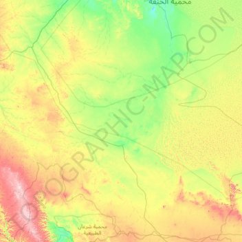
Name: Tayma topographic map, elevation, terrain.
Location: Tayma, Tabuk Province, 45911, Saudi Arabia (26.74772 37.65558 28.93675 39.94176)
Average elevation: 3,225 ft
Minimum elevation: 2,444 ft
Maximum elevation: 5,791 ft
Make a donation
Gear up for your next adventure:
As an Amazon Associate, this site earns from qualifying purchases at no extra cost to you.
Other topographic maps
Click on a map to view its topography, its elevation and its terrain.
Neom
On 3 March 2022, Saudi Crown Prince Mohammed bin Salman launched the Trojena project, which will be the first major outdoor skiing destination in the Arabian Peninsula. It will be located in Saudi Arabia's highest mountain range, about 50 kilometres (31 mi) from the Gulf of Aqaba coast, with elevations ranging…
Average elevation: 171 ft
Make a donation
Gear up for your next adventure:
As an Amazon Associate, this site earns from qualifying purchases at no extra cost to you.