
Thank you for supporting this site ❤️
Make a donation
Make a donation
Gear up for your next adventure:
As an Amazon Associate, this site earns from qualifying purchases at no extra cost to you.
Robledillo topographic map
Click on the map to display elevation.
Thank you for supporting this site ❤️
Make a donation
Make a donation
Gear up for your next adventure:
As an Amazon Associate, this site earns from qualifying purchases at no extra cost to you.
About this map
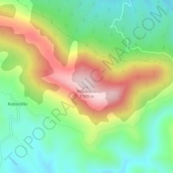
Name: Robledillo topographic map, elevation, terrain.
Location: Robledillo, Robledo del Mazo, Castilië-La Mancha, Spanje (39.60364 -4.81243 39.60374 -4.81233)
Average elevation: 3,094 ft
Minimum elevation: 2,579 ft
Maximum elevation: 3,894 ft
Thank you for supporting this site ❤️
Make a donation
Make a donation
Gear up for your next adventure:
As an Amazon Associate, this site earns from qualifying purchases at no extra cost to you.