
Thank you for supporting this site ❤️
Make a donation
Make a donation
Gear up for your next adventure:
As an Amazon Associate, this site earns from qualifying purchases at no extra cost to you.
Turons topographic map
Click on the map to display elevation.
Thank you for supporting this site ❤️
Make a donation
Make a donation
Gear up for your next adventure:
As an Amazon Associate, this site earns from qualifying purchases at no extra cost to you.
About this map
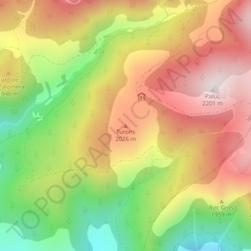
Name: Turons topographic map, elevation, terrain.
Location: Turons, les Valls de Valira, Alto Urgel, Cataluña, España (42.41066 1.57239 42.41076 1.57249)
Average elevation: 6,158 ft
Minimum elevation: 4,997 ft
Maximum elevation: 7,198 ft
Thank you for supporting this site ❤️
Make a donation
Make a donation
Gear up for your next adventure:
As an Amazon Associate, this site earns from qualifying purchases at no extra cost to you.