
Thank you for supporting this site ❤️
Make a donation
Make a donation
Gear up for your next adventure:
As an Amazon Associate, this site earns from qualifying purchases at no extra cost to you.
Changqing topographic map
Click on the map to display elevation.
Thank you for supporting this site ❤️
Make a donation
Make a donation
Gear up for your next adventure:
As an Amazon Associate, this site earns from qualifying purchases at no extra cost to you.
About this map
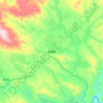
Name: Changqing topographic map, elevation, terrain.
Location: Changqing, Anxi County, Quanzhou, Fujian, China (25.15638 117.82741 25.23638 117.90741)
Average elevation: 2,428 ft
Minimum elevation: 1,385 ft
Maximum elevation: 4,101 ft
Thank you for supporting this site ❤️
Make a donation
Make a donation
Gear up for your next adventure:
As an Amazon Associate, this site earns from qualifying purchases at no extra cost to you.