
Thank you for supporting this site ❤️
Make a donation
Make a donation
Gear up for your next adventure:
As an Amazon Associate, this site earns from qualifying purchases at no extra cost to you.
Namie topographic map
Click on the map to display elevation.
Thank you for supporting this site ❤️
Make a donation
Make a donation
Gear up for your next adventure:
As an Amazon Associate, this site earns from qualifying purchases at no extra cost to you.
About this map
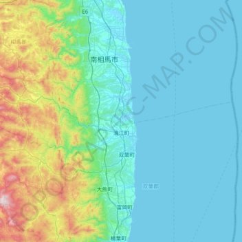
Name: Namie topographic map, elevation, terrain.
Location: Namie, Futaba County, Fukushima Prefecture, 979-1513, Japan (37.41950 140.68367 37.61482 141.29516)
Average elevation: 617 ft
Minimum elevation: -7 ft
Maximum elevation: 3,842 ft
Thank you for supporting this site ❤️
Make a donation
Make a donation
Gear up for your next adventure:
As an Amazon Associate, this site earns from qualifying purchases at no extra cost to you.