Geolocate

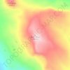
Marble topographic map

Click on the map to display elevation.

About this map
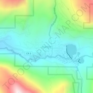
Name: Marble topographic map, elevation, terrain.

Location: Marble, Gunnison County, Colorado, United States (39.06769 -107.19962 39.07676 -107.18179)

Average elevation: 8,566 ft

Minimum elevation: 7,844 ft

Maximum elevation: 10,240 ft

Gunnison County trails, hiking, mountain biking, running and outdoor activities

Other topographic maps

Click on a map to view its topography, its elevation and its terrain.
Whitepine

United States > Colorado > Gunnison County

Average elevation: 10,505 ft

Gunnison

United States > Colorado > Gunnison County

Also in 1880, the cattle industry in Gunnison was established. Realizing the poor conditions for farming (with only about eleven inches of rainfall annually and the short growing season due to the high elevation and alpine environment) the local farmers turned to ranching and began breeding cattle. To do this…

Average elevation: 7,772 ft
Buck Mesa

United States > Colorado > Gunnison County

Average elevation: 9,337 ft

Granite Basin

United States > Colorado > Gunnison County

Average elevation: 10,509 ft

Copper Mountain

United States > Colorado > Gunnison County

Average elevation: 10,082 ft

Floresta

United States > Colorado > Gunnison County

Average elevation: 10,203 ft

Gear up for your next adventure:

🪵Folding Camp Saw - Compact saw for wood and campsite work
🦶Hiking Gaiters - Keep debris and water out of your boots
🧭Hiking Compass - Precision compass for reliable navigation in the wilderness
🥤Water Filter Bottle - All‑in‑one filter bottle for safe hydration
🎒Trail Energy Bars - High‑calorie bars for hiking energy

As an Amazon Associate, this site earns from qualifying purchases at no extra cost to you.