Geolocate

Neureuth topographic map

Click on the map to display elevation.

About this map

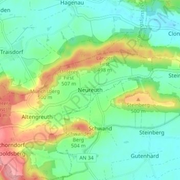
Name: Neureuth topographic map, elevation, terrain.

Location: Neureuth, Schillingsfürst, Schillingsfürst (VGem), Landkreis Ansbach, Bayern, 91592, Deutschland (49.27648 10.30929 49.31648 10.34929)

Average elevation: 1,506 ft

Minimum elevation: 1,398 ft

Maximum elevation: 1,732 ft

Other topographic maps

Click on a map to view its topography, its elevation and its terrain.

Gear up for your next adventure:

🧯Emergency Survival Kit - All‑in‑one survival essentials for the backcountry
🏔️Mountain Trail Maps - High‑detail maps for popular peaks
🧥Waterproof Jacket for Hiking - Breathable and rugged rain jacket for outdoor excursions
🎒Waterproof Dry Bags - Keep your electronics and maps dry inside your pack
🗺️NatGeo Topo Maps - High-quality waterproof printed topographic maps of US Parks

As an Amazon Associate, this site earns from qualifying purchases at no extra cost to you.