Geolocate

Whitewright topographic map

Click on the map to display elevation.

About this map

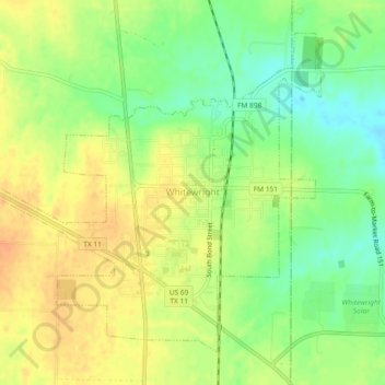
Name: Whitewright topographic map, elevation, terrain.

Location: Whitewright, Grayson County, Texas, United States (33.49624 -96.42534 33.52809 -96.37931)

Average elevation: 755 ft

Minimum elevation: 686 ft

Maximum elevation: 807 ft

Grayson County trails, hiking, mountain biking, running and outdoor activities

Gear up for your next adventure:

🧴Hand Sanitizer - Keep hands clean while hiking
🥩Freeze-Dried Meals - Nutritious and lightweight food for remote expeditions
📡GPS Antenna Upgrade - Enhance GPS reception in remote terrain
🧺Microfiber Travel Towels - Compact and fast-drying towels for trail use
📚USA Hiking Guide Books - Top trail guides and map books

As an Amazon Associate, this site earns from qualifying purchases at no extra cost to you.