Geolocate

Taswell topographic map

Click on the map to display elevation.

About this map

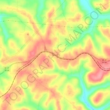
Name: Taswell topographic map, elevation, terrain.

Location: Taswell, Crawford County, Indiana, 47175, United States (38.31423 -86.58110 38.35423 -86.54110)

Average elevation: 715 ft

Minimum elevation: 531 ft

Maximum elevation: 846 ft

Crawford County trails, hiking, mountain biking, running and outdoor activities

Other topographic maps

Click on a map to view its topography, its elevation and its terrain.

Leavenworth

United States > Indiana > Crawford County

Average elevation: 522 ft

English

United States > Indiana > Crawford County

Average elevation: 604 ft

Marengo

United States > Indiana > Crawford County

Average elevation: 676 ft

English

United States > Indiana > Crawford County

Average elevation: 604 ft

English

United States > Indiana > Crawford County

Average elevation: 604 ft

English

United States > Indiana > Crawford County

Average elevation: 604 ft

Marengo

United States > Indiana > Crawford County

Average elevation: 676 ft

Gear up for your next adventure:

🌡️Handheld Weather Meters - Measure wind, temp, and pressure for safe mountain travel
📶Vehicle Signal Boosters - Improve reception in rural areas while driving to trailheads
🎒Day Hiking Backpack - Lightweight backpack perfect for day trips and outdoor adventures
🧷Carabiner Set - Durable clips for gear attachment
🪵Folding Camp Saw - Compact saw for wood and campsite work

As an Amazon Associate, this site earns from qualifying purchases at no extra cost to you.