
Thank you for supporting this site ❤️
Make a donation
Make a donation
Gear up for your next adventure:
As an Amazon Associate, this site earns from qualifying purchases at no extra cost to you.
Nagarjuna topographic map
Click on the map to display elevation.
Thank you for supporting this site ❤️
Make a donation
Make a donation
Gear up for your next adventure:
As an Amazon Associate, this site earns from qualifying purchases at no extra cost to you.
About this map
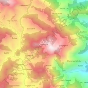
Name: Nagarjuna topographic map, elevation, terrain.
Location: Nagarjuna, Syalde, Almora, Uttarakhand, India (29.85039 79.10552 29.89039 79.14552)
Average elevation: 5,610 ft
Minimum elevation: 4,052 ft
Maximum elevation: 6,759 ft
Thank you for supporting this site ❤️
Make a donation
Make a donation
Gear up for your next adventure:
As an Amazon Associate, this site earns from qualifying purchases at no extra cost to you.