
Thank you for supporting this site ❤️
Make a donation
Make a donation
Gear up for your next adventure:
As an Amazon Associate, this site earns from qualifying purchases at no extra cost to you.
Pucara topographic map
Click on the map to display elevation.
Thank you for supporting this site ❤️
Make a donation
Make a donation
Gear up for your next adventure:
As an Amazon Associate, this site earns from qualifying purchases at no extra cost to you.
About this map
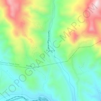
Name: Pucara topographic map, elevation, terrain.
Location: Pucara, Potosí, Provincia Tomás Frías, Potosí, Bolivia (-19.50083 -65.61669 -19.46083 -65.57669)
Average elevation: 12,346 ft
Minimum elevation: 11,572 ft
Maximum elevation: 13,816 ft
Thank you for supporting this site ❤️
Make a donation
Make a donation
Gear up for your next adventure:
As an Amazon Associate, this site earns from qualifying purchases at no extra cost to you.