
Thank you for supporting this site ❤️
Make a donation
Make a donation
Gear up for your next adventure:
As an Amazon Associate, this site earns from qualifying purchases at no extra cost to you.
Collina topographic map
Click on the map to display elevation.
Thank you for supporting this site ❤️
Make a donation
Make a donation
Gear up for your next adventure:
As an Amazon Associate, this site earns from qualifying purchases at no extra cost to you.
About this map
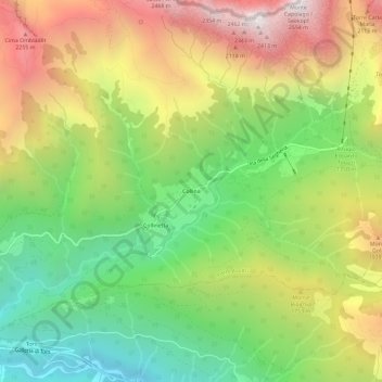
Name: Collina topographic map, elevation, terrain.
Location: Collina, Forni Avoltri, Udine, Friuli-Venezia Giulia, Italy (46.56664 12.82438 46.60664 12.86438)
Average elevation: 4,967 ft
Minimum elevation: 2,349 ft
Maximum elevation: 8,251 ft
Thank you for supporting this site ❤️
Make a donation
Make a donation
Gear up for your next adventure:
As an Amazon Associate, this site earns from qualifying purchases at no extra cost to you.