Geolocate

Dore Lake topographic map

Click on the map to display elevation.

About this map

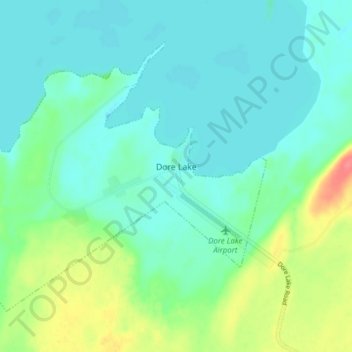
Name: Dore Lake topographic map, elevation, terrain.

Location: Dore Lake, Division No. 18, Saskatchewan, Canada (54.60718 -107.45350 54.64150 -107.37615)

Average elevation: 1,542 ft

Minimum elevation: 1,493 ft

Maximum elevation: 1,686 ft

Other topographic maps

Click on a map to view its topography, its elevation and its terrain.

Missinipe

Canada > Saskatchewan > Division No. 18

Average elevation: 1,247 ft

Gear up for your next adventure:

🎒Gear Packing Cubes - Organize your backpack efficiently
🎒Hydration Pack - Hands‑free water reservoir for long hikes
🔥Plasma Lighters - Windproof lighters that work in any weather condition
🧭GPS Watch Accessories - Bands and chargers for GPS watches
🥩Freeze-Dried Meals - Nutritious and lightweight food for remote expeditions

As an Amazon Associate, this site earns from qualifying purchases at no extra cost to you.