Geolocate

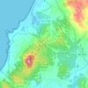
Iroite topographic map

Click on the map to display elevation.

About this map

Name: Iroite topographic map, elevation, terrain.

Location: Iroite, O Porto do Son, Noia, La Coruña, Galicia, 15999, España (42.72842 -8.92569 42.72852 -8.92559)

Average elevation: 1,591 ft

Minimum elevation: 499 ft

Maximum elevation: 2,247 ft

Other topographic maps

Click on a map to view its topography, its elevation and its terrain.
San Pedro de Muro

España > Galicia > Noia > O Porto do Son

Average elevation: 161 ft

Gear up for your next adventure:

☀️Outdoor Sunscreen - High protection sunscreen for outdoor activities
🪶LED Camping Lantern - Bright lantern for camp lighting
🪶Wildlife Field Guides - Learn animal tracking and species ID
🧤Hiking Gloves - Protective gloves for rugged trails
🥩Freeze-Dried Meals - Nutritious and lightweight food for remote expeditions

As an Amazon Associate, this site earns from qualifying purchases at no extra cost to you.