
Chendurthi topographic map
Click on the map to display elevation.
About this map
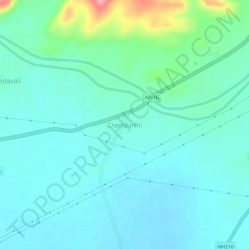
Name: Chendurthi topographic map, elevation, terrain.
Location: Chendurthi, Gollaprolu, Kakinada, Andhra Pradesh, India (17.20257 82.27507 17.24257 82.31507)
Average elevation: 121 ft
Minimum elevation: 52 ft
Maximum elevation: 423 ft