Geolocate

Navarro topographic map

Click on the map to display elevation.

About this map

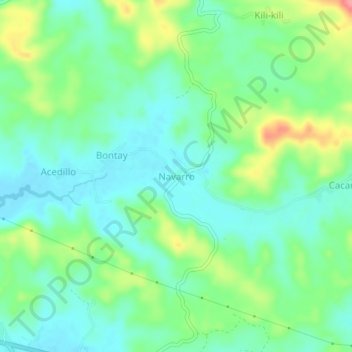
Name: Navarro topographic map, elevation, terrain.

Location: Navarro, Calbayog, Samar, Eastern Visayas, 6710, Philippines (12.08309 124.54378 12.12309 124.58378)

Average elevation: 92 ft

Minimum elevation: 3 ft

Maximum elevation: 289 ft

Other topographic maps

Click on a map to view its topography, its elevation and its terrain.

Gear up for your next adventure:

📦Gear Storage Bags - Organize and protect outdoor equipment
🥘Titanium Cookware - Durable, featherlight pots and pans for backpacking
🛶Inflatable Kayak - Portable kayak for rivers, lakes, and expeditions
🛡️Insect Repellent - Protection against bugs during outdoor activities
🧥Men's Rain Shells - Premium waterproof and breathable jackets for mountain weather

As an Amazon Associate, this site earns from qualifying purchases at no extra cost to you.